Alone on the Dempster
Alone on the Dempster

Alone on the Dempster
YouTube video highlight
I noticed the grizzly bear as I crested the hill, out of breath, dehydrated and legs aching.
Read more about the projectI noticed the grizzly bear as I crested the hill, out of breath, dehydrated and legs aching. It took a moment to compute the dark shape alongside the empty highway. But once I did, my heart started racing. I swerved my bike to the opposite side of the road in a panic and scrambled to pull out my bear spray from the bottom of my handlebar bag. All the while trying to keep an eye on the bear.
The bear was dark brown, its coarse fur accentuating the unmistakable hump on its back. A grizzly bear, probably a juvenile. The bear looked at me, took two steps, and then charged.
It took the bear less than three seconds to reach the edge of the road. I was trembling from head to toe as it halted 20 feet away. Then it began to circle me.
It was Day three of what was supposed to be a three week solo bike trip across the Yukon. I was petrified.

I had expected to see bears on this trip. It’s the Yukon after all. Roadsides provide an abundance of flowers and grasses, which add bulk to a bear’s diet. I'd had close bear encounters before but nothing like this. This was not how I expected bears to react.
As the bear began to slowly and methodically circle me, I tried to talk in a low tone, hoping the sound of my voice would scare it. No luck. It kept walking, watching me. At that moment I heard a truck coming up the hill and I started to frantically wave at it with one arm. The truck didn’t seem to notice the face off happening in the middle of the highway. But as the truck came over the hill and barreled down the road between me and the bear, the grizzly turned on its haunches and disappeared into the bushes. I almost collapsed in relief.
That was to be the first of many bear encounters along my route. But by far the most memorable. Standing on the side of the highway, in the middle of nowhere, with 200km to the nearest town, there was nothing to do but shakily get on my bike and keep pedaling.

It was the summer of 2020. I had started my journey in Whitehorse, three days previous, pedaling out of the city in the rain. Throughout the next 14 days I cycled up the Klondike Highway and then up the notorious Dempster Highway to the NorthWest Territories (NWT) border. I couldn’t cross the border due to Covid-19 restrictions, so there, just 200kms as the crow flies from the Arctic Ocean, I turned around and cycled back to Dawson City, which sits near the western border of the Yukon.
The first few days were an educational experience as I learned the quirks of my new-used bike. Despite the scale of my enthusiasm when it comes to adventure, I am in no way an expert when it comes to bikes or touring. I had bought this bike on a whim a few years previous, brought it to a shop and was promptly told that almost every part of the bike would have to be replaced. Having already spent a few hundred bucks on the bike, and not prepared to find another one, I handed over my bike to the mechanic, grimacing as I felt my bank account further dwindling.
I fixed what seemed the most essential – the brakes, a new chain, one new gear cable, and hoped the rest would hold up.
Since then I had only used the bike a few times, unearthing it from my storage locker for this trip.

I quickly discovered that I had to shift my gears in a specific order, or my chain would fall off and get jammed in between the frame. The result being that I would have to take my bike chain apart, which is no small feat and took me two hours the first time while battling mosquitos on the side of the highway. For an experienced mechanic it takes about 2 seconds. I learned that although master-chain links are meant to be easily removed, some (ie: mine) can become welded together by dirt and age. Also gear (and sometimes brake) cables will stop working if enough mud solidifies on them, which they are prone to do on the Dempster.
Perhaps most importantly, I learned that in the Yukon those blue squiggly lines on maps don’t necessarily mean there is water. In fact it’s safer to assume that unless something is marked as a river, it’s probably a dried up swamp.
I ran out of water. A lot.

I biked in and out of storms, and as I struggled up hills with water running down my back, I reminded myself for the hundredth time that my raincoat was in fact not waterproof.
But then the struggles smoothed themselves out and I began to sail down the roads, singing as the wind blew my hair and the sun brought out the freckles on my face. My body slipped into the groove of things, my legs turning my pedals mechanically and without thought. Muscle memory kicking in. Stunted spruce trees lined the sides of the highway, drunkenly waving back and forth due to the melting of permafrost.
It felt good to be facing my fears and pushing on with this route, despite the laundry list of things that had gone wrong.

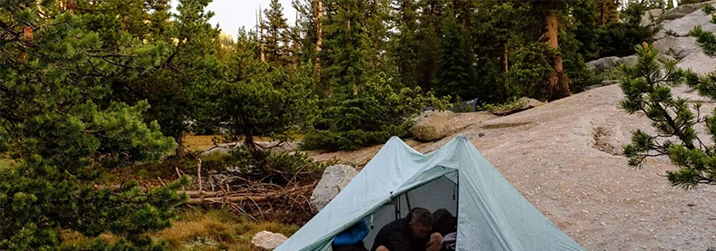
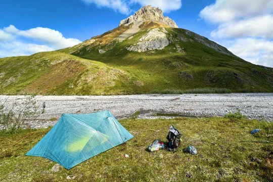
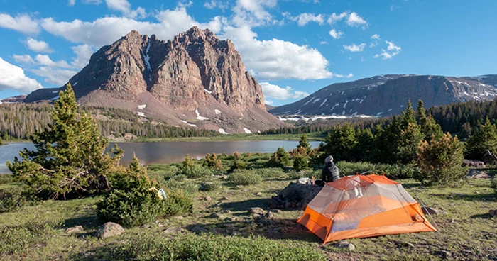
Every evening as my legs began to protest and the sun would dip lower on the horizon, I would begin to search for a campsite for the night. First I would have to find water, or ideally find a clearing by a river. Usually it would take a few tries of bumping my way down overgrown mining roads, till I found a secluded spot to pitch my tent. I would try to pick areas that were a little ways from the main road, so that there was less chance of unwelcome visitors. Often I would end up with spectacular spots overlooking the mountains, all to myself. After a quick meal and perhaps a bath in the river, I would cocoon myself in my sleeping bag, falling asleep quickly as the sky darkened and the stars came out.
On Day 5 (500 km into my trip) I started up the Dempster Highway, excitement and nervousness bubbling in my stomach. The Dempster Highway is a remote glorified dirt road. It's known for puncturing tires and breaking cars. It is a rite of passage for motorcyclists and for anyone living up north. In Dawson City, tourists gather in bars to compare stories of how many flat tires they got, and the hodgepodge repair jobs they did on the side of the road. This area is also known for bears, moose, sheep, caribou and wolves. With all of this in mind, I rode over the Klondike River Bridge which marks the start, hooting and hollering in excitement.

A couple of kilometers in, a couple slowed their car to warn me of a black bear just up the road.
“Thanks for the heads up,” I said, smiling with false confidence. At least it’s only a black bear I told myself, trying to forget about the bear encounter three days previous. I often bull doze my way through life, and this trip was going to be no different. Positive thoughts were going to propel me down this highway.
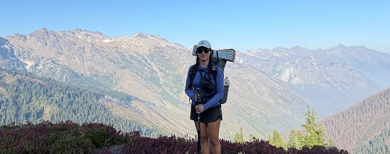
I cycled off, weaving in and out of pot holes while belting out distorted song lyrics that I had long since forgotten. Fears of turning corners and coming across grizzly bears slowly abated. I didn’t see any bears that day, or for a few days. When I reached Tombstone Territorial Park, I parked my bike at a trailhead and spent a blissful three days hiking, giving my legs a much needed break from the repetitive motion of pedaling. It’s good to get off the roads sometimes but by Day nine I eagerly stuffed my backpack back into my dry bag and headed north on my bike once again.

As I departed from the park my bike was weighed down with ten days of food, the result of the NWT border being closed. The only towns to resupply along the Dempster Highway are Fort McPherson, Inuvik and Tuktoyaktuk, all located in the far north of the NWT. A friend had kindly dropped off a resupply box for me at Tombstone Park Campground, which let me avoid a detour to the grocery store in Dawson. However, I was still carrying enough food to get me the 900km up and down the Dempster Highway and out to Dawson.
To say my bike was heavy was an understatement.
For the next three days I pushed north, battling a slight yet persistent headwind. The landscape changed as kilometers flew by. The jagged peaks of the Tombstone mountains gave way to open plains, and then to the gray Ogilvie mountains. Valleys opened up alongside the road, beckoning to be explored. This road doesn’t see a lot of traffic, and that was particularly true this year due to covid-19 travel restrictions. On average about 10 cars passed a day, the majority of whom stopped to check up on me as I biked. Strangers would push food, water and beer on me, cook me dinner or simply stop to talk on the side of the road. I got a few raised eyebrows when I told people what I was doing. Many locals asked if I was carrying a shotgun (I wasn’t). But thankfully no one questioned my ability to be doing what I was doing on the basis of me being a solo woman.

At this point in life I’ve done a lot of solo trips, and on every single one I’ve had people question my ability to be out there. Unsolicited advice, largely from men, is common. But I’ve also had plenty of women look at me and say “you’re so brave to be out here alone”. Comments like these always frustrate me and I want to ask them why they think that and if they would ask that to a man.
I left on this trip with a healthy amount of fear, however, a long time ago I decided that that fear wasn’t going to hold me back.
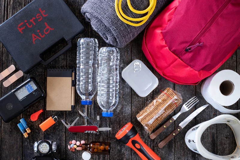
I researched what I could beforehand, brought a first aid kit, bear spray and a repair kit for my bike and other gear. I trusted that if something went wrong I would find a solution or worst case scenario, ask someone for help. If anything, this trip solidified for me the kindness and generosity of strangers, and also showed me what I am capable of.

Next I started up 7 Mile Hill, a long unrelenting climb to the Eagle Plateau. A climb that was most certainly not intended for cyclists. From there the road rides like an unruly wave, bucking and winding its way in a frustratingly non-linear fashion. The excitement of going downhill was replaced by anxiety of losing control and crashing, as the road surface deteriorated to shale and sand. Deep grooves of silt on the highway would catch my tires, causing me to careen off the road. I saw a few black bears in the distance but they all darted off when I yelled out, helping calm my fears. Truck drivers would slow their rigs as they passed, a kind gesture but it did little to lessen the inevitable dust clouds that would envelop me in their wake. In the morning, dust would hang over the road, lingering in the dawn air, waiting for a breeze to pick up and carry it away in miniaturized tornados.
At night I would peel off my clothes to find that the sand and dust had infiltrated every part of my being.
The waistband of my shorts and the seams of my sports bra felt stiff with caked sweat and dirt. I was developing painful saddle sores from biking 10 hours a day. Bathing in the frigid rivers provided some relief but only until I got back on my bike.

Yet this place had captured my heart and soul. I would often bike late into the evening, wanting nothing more than to see what lay around the next bend. Intricate rock patterns and spectacular ridgelines enticed me to stop, but never for long enough. I consoled myself that I would return to explore more one day.
My goal of reaching the Yukon-NWT border was cut short by 10km, on account of a mama grizzly and her two cubs. The bear family had taken up residence in the grassy plains alongside the highway, just shy of the border. I came across them early in the morning, the sky still a light pink under a tapestry of cotton candy clouds. I noticed the beige bumps in the distance, at first mistaking them for bushes. But then the mother bear stood up, her large unambiguous silhouette towering over the grasses. My heart began to race, and I quickly halted to pull my bear spray out. Flashbacks of the last encounter raced through my mind and I knew that I wouldn’t be saved by a truck this early in the morning.
The mama bear raised her nose to sniff the air, then apparently indifferent, went back to grazing. The family had no plans of moving.
I stood on the road, briefly watching them feed in the morning light before quietly turning back and gliding downhill, heading south for the first time on my journey.

It seemed fitting that bears would mark the most northern point of this journey. It’s their territory after all and I’m just a guest. In reality, if there wasn’t a sign marking the border, one would never know that they were at a junction. A dividing line between laws and people. The border checkpoint is another dozen kilometers away, at the Peel River. Physically there is no difference on either side of the border, it is all a beautiful, vast expanse of wilderness. What’s a border anyways than an arbitrary line drawn on a map, disputed in political institutions? The animals, the plants and insects, they have no use for such a thing. They go about their day unfazed by and unaware of this invisible line. Border lines are a product of people, of our culture.
This summer - this year really - none of it had gone to plan. So why would this?
Besides I had 570km left to ride back to Dawson City, and an unknown number of bear encounters ahead of me.

Alone on the Dempster


I noticed the grizzly bear as I crested the hill, out of breath, dehydrated and legs aching. It took a moment to compute the dark shape alongside the empty highway. But once I did, my heart started racing. I swerved my bike to the opposite side of the road in a panic and scrambled to pull out my bear spray from the bottom of my handlebar bag. All the while trying to keep an eye on the bear.
The bear was dark brown, its coarse fur accentuating the unmistakable hump on its back. A grizzly bear, probably a juvenile. The bear looked at me, took two steps, and then charged.
It took the bear less than three seconds to reach the edge of the road. I was trembling from head to toe as it halted 20 feet away. Then it began to circle me.
It was Day three of what was supposed to be a three week solo bike trip across the Yukon. I was petrified.

I had expected to see bears on this trip. It’s the Yukon after all. Roadsides provide an abundance of flowers and grasses, which add bulk to a bear’s diet. I'd had close bear encounters before but nothing like this. This was not how I expected bears to react.
As the bear began to slowly and methodically circle me, I tried to talk in a low tone, hoping the sound of my voice would scare it. No luck. It kept walking, watching me. At that moment I heard a truck coming up the hill and I started to frantically wave at it with one arm. The truck didn’t seem to notice the face off happening in the middle of the highway. But as the truck came over the hill and barreled down the road between me and the bear, the grizzly turned on its haunches and disappeared into the bushes. I almost collapsed in relief.
That was to be the first of many bear encounters along my route. But by far the most memorable. Standing on the side of the highway, in the middle of nowhere, with 200km to the nearest town, there was nothing to do but shakily get on my bike and keep pedaling.

It was the summer of 2020. I had started my journey in Whitehorse, three days previous, pedaling out of the city in the rain. Throughout the next 14 days I cycled up the Klondike Highway and then up the notorious Dempster Highway to the NorthWest Territories (NWT) border. I couldn’t cross the border due to Covid-19 restrictions, so there, just 200kms as the crow flies from the Arctic Ocean, I turned around and cycled back to Dawson City, which sits near the western border of the Yukon.
The first few days were an educational experience as I learned the quirks of my new-used bike. Despite the scale of my enthusiasm when it comes to adventure, I am in no way an expert when it comes to bikes or touring. I had bought this bike on a whim a few years previous, brought it to a shop and was promptly told that almost every part of the bike would have to be replaced. Having already spent a few hundred bucks on the bike, and not prepared to find another one, I handed over my bike to the mechanic, grimacing as I felt my bank account further dwindling.
I fixed what seemed the most essential – the brakes, a new chain, one new gear cable, and hoped the rest would hold up.
Since then I had only used the bike a few times, unearthing it from my storage locker for this trip.

I quickly discovered that I had to shift my gears in a specific order, or my chain would fall off and get jammed in between the frame. The result being that I would have to take my bike chain apart, which is no small feat and took me two hours the first time while battling mosquitos on the side of the highway. For an experienced mechanic it takes about 2 seconds. I learned that although master-chain links are meant to be easily removed, some (ie: mine) can become welded together by dirt and age. Also gear (and sometimes brake) cables will stop working if enough mud solidifies on them, which they are prone to do on the Dempster.
Perhaps most importantly, I learned that in the Yukon those blue squiggly lines on maps don’t necessarily mean there is water. In fact it’s safer to assume that unless something is marked as a river, it’s probably a dried up swamp.
I ran out of water. A lot.

I biked in and out of storms, and as I struggled up hills with water running down my back, I reminded myself for the hundredth time that my raincoat was in fact not waterproof.
But then the struggles smoothed themselves out and I began to sail down the roads, singing as the wind blew my hair and the sun brought out the freckles on my face. My body slipped into the groove of things, my legs turning my pedals mechanically and without thought. Muscle memory kicking in. Stunted spruce trees lined the sides of the highway, drunkenly waving back and forth due to the melting of permafrost.
It felt good to be facing my fears and pushing on with this route, despite the laundry list of things that had gone wrong.

Every evening as my legs began to protest and the sun would dip lower on the horizon, I would begin to search for a campsite for the night. First I would have to find water, or ideally find a clearing by a river. Usually it would take a few tries of bumping my way down overgrown mining roads, till I found a secluded spot to pitch my tent. I would try to pick areas that were a little ways from the main road, so that there was less chance of unwelcome visitors. Often I would end up with spectacular spots overlooking the mountains, all to myself. After a quick meal and perhaps a bath in the river, I would cocoon myself in my sleeping bag, falling asleep quickly as the sky darkened and the stars came out.
On Day 5 (500 km into my trip) I started up the Dempster Highway, excitement and nervousness bubbling in my stomach. The Dempster Highway is a remote glorified dirt road. It's known for puncturing tires and breaking cars. It is a rite of passage for motorcyclists and for anyone living up north. In Dawson City, tourists gather in bars to compare stories of how many flat tires they got, and the hodgepodge repair jobs they did on the side of the road. This area is also known for bears, moose, sheep, caribou and wolves. With all of this in mind, I rode over the Klondike River Bridge which marks the start, hooting and hollering in excitement.

A couple of kilometers in, a couple slowed their car to warn me of a black bear just up the road.
“Thanks for the heads up,” I said, smiling with false confidence. At least it’s only a black bear I told myself, trying to forget about the bear encounter three days previous. I often bull doze my way through life, and this trip was going to be no different. Positive thoughts were going to propel me down this highway.
I cycled off, weaving in and out of pot holes while belting out distorted song lyrics that I had long since forgotten. Fears of turning corners and coming across grizzly bears slowly abated. I didn’t see any bears that day, or for a few days. When I reached Tombstone Territorial Park, I parked my bike at a trailhead and spent a blissful three days hiking, giving my legs a much needed break from the repetitive motion of pedaling. It’s good to get off the roads sometimes but by Day nine I eagerly stuffed my backpack back into my dry bag and headed north on my bike once again.

As I departed from the park my bike was weighed down with ten days of food, the result of the NWT border being closed. The only towns to resupply along the Dempster Highway are Fort McPherson, Inuvik and Tuktoyaktuk, all located in the far north of the NWT. A friend had kindly dropped off a resupply box for me at Tombstone Park Campground, which let me avoid a detour to the grocery store in Dawson. However, I was still carrying enough food to get me the 900km up and down the Dempster Highway and out to Dawson.
To say my bike was heavy was an understatement.
For the next three days I pushed north, battling a slight yet persistent headwind. The landscape changed as kilometers flew by. The jagged peaks of the Tombstone mountains gave way to open plains, and then to the gray Ogilvie mountains. Valleys opened up alongside the road, beckoning to be explored. This road doesn’t see a lot of traffic, and that was particularly true this year due to covid-19 travel restrictions. On average about 10 cars passed a day, the majority of whom stopped to check up on me as I biked. Strangers would push food, water and beer on me, cook me dinner or simply stop to talk on the side of the road. I got a few raised eyebrows when I told people what I was doing. Many locals asked if I was carrying a shotgun (I wasn’t). But thankfully no one questioned my ability to be doing what I was doing on the basis of me being a solo woman.

At this point in life I’ve done a lot of solo trips, and on every single one I’ve had people question my ability to be out there. Unsolicited advice, largely from men, is common. But I’ve also had plenty of women look at me and say “you’re so brave to be out here alone”. Comments like these always frustrate me and I want to ask them why they think that and if they would ask that to a man.
I left on this trip with a healthy amount of fear, however, a long time ago I decided that that fear wasn’t going to hold me back.
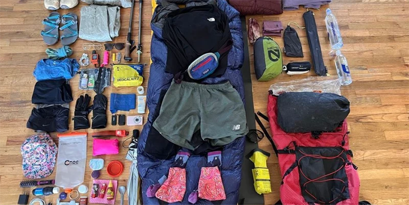
I researched what I could beforehand, brought a first aid kit, bear spray and a repair kit for my bike and other gear. I trusted that if something went wrong I would find a solution or worst case scenario, ask someone for help. If anything, this trip solidified for me the kindness and generosity of strangers, and also showed me what I am capable of.

Next I started up 7 Mile Hill, a long unrelenting climb to the Eagle Plateau. A climb that was most certainly not intended for cyclists. From there the road rides like an unruly wave, bucking and winding its way in a frustratingly non-linear fashion. The excitement of going downhill was replaced by anxiety of losing control and crashing, as the road surface deteriorated to shale and sand. Deep grooves of silt on the highway would catch my tires, causing me to careen off the road. I saw a few black bears in the distance but they all darted off when I yelled out, helping calm my fears. Truck drivers would slow their rigs as they passed, a kind gesture but it did little to lessen the inevitable dust clouds that would envelop me in their wake. In the morning, dust would hang over the road, lingering in the dawn air, waiting for a breeze to pick up and carry it away in miniaturized tornados.
At night I would peel off my clothes to find that the sand and dust had infiltrated every part of my being.
The waistband of my shorts and the seams of my sports bra felt stiff with caked sweat and dirt. I was developing painful saddle sores from biking 10 hours a day. Bathing in the frigid rivers provided some relief but only until I got back on my bike.

Yet this place had captured my heart and soul. I would often bike late into the evening, wanting nothing more than to see what lay around the next bend. Intricate rock patterns and spectacular ridgelines enticed me to stop, but never for long enough. I consoled myself that I would return to explore more one day.
My goal of reaching the Yukon-NWT border was cut short by 10km, on account of a mama grizzly and her two cubs. The bear family had taken up residence in the grassy plains alongside the highway, just shy of the border. I came across them early in the morning, the sky still a light pink under a tapestry of cotton candy clouds. I noticed the beige bumps in the distance, at first mistaking them for bushes. But then the mother bear stood up, her large unambiguous silhouette towering over the grasses. My heart began to race, and I quickly halted to pull my bear spray out. Flashbacks of the last encounter raced through my mind and I knew that I wouldn’t be saved by a truck this early in the morning.
The mama bear raised her nose to sniff the air, then apparently indifferent, went back to grazing. The family had no plans of moving.
I stood on the road, briefly watching them feed in the morning light before quietly turning back and gliding downhill, heading south for the first time on my journey.

It seemed fitting that bears would mark the most northern point of this journey. It’s their territory after all and I’m just a guest. In reality, if there wasn’t a sign marking the border, one would never know that they were at a junction. A dividing line between laws and people. The border checkpoint is another dozen kilometers away, at the Peel River. Physically there is no difference on either side of the border, it is all a beautiful, vast expanse of wilderness. What’s a border anyways than an arbitrary line drawn on a map, disputed in political institutions? The animals, the plants and insects, they have no use for such a thing. They go about their day unfazed by and unaware of this invisible line. Border lines are a product of people, of our culture.
This summer - this year really - none of it had gone to plan. So why would this?
Besides I had 570km left to ride back to Dawson City, and an unknown number of bear encounters ahead of me.

Alone on the Dempster


I noticed the grizzly bear as I crested the hill, out of breath, dehydrated and legs aching. It took a moment to compute the dark shape alongside the empty highway. But once I did, my heart started racing. I swerved my bike to the opposite side of the road in a panic and scrambled to pull out my bear spray from the bottom of my handlebar bag. All the while trying to keep an eye on the bear.
The bear was dark brown, its coarse fur accentuating the unmistakable hump on its back. A grizzly bear, probably a juvenile. The bear looked at me, took two steps, and then charged.
It took the bear less than three seconds to reach the edge of the road. I was trembling from head to toe as it halted 20 feet away. Then it began to circle me.
It was Day three of what was supposed to be a three week solo bike trip across the Yukon. I was petrified.

I had expected to see bears on this trip. It’s the Yukon after all. Roadsides provide an abundance of flowers and grasses, which add bulk to a bear’s diet. I'd had close bear encounters before but nothing like this. This was not how I expected bears to react.
As the bear began to slowly and methodically circle me, I tried to talk in a low tone, hoping the sound of my voice would scare it. No luck. It kept walking, watching me. At that moment I heard a truck coming up the hill and I started to frantically wave at it with one arm. The truck didn’t seem to notice the face off happening in the middle of the highway. But as the truck came over the hill and barreled down the road between me and the bear, the grizzly turned on its haunches and disappeared into the bushes. I almost collapsed in relief.
That was to be the first of many bear encounters along my route. But by far the most memorable. Standing on the side of the highway, in the middle of nowhere, with 200km to the nearest town, there was nothing to do but shakily get on my bike and keep pedaling.

It was the summer of 2020. I had started my journey in Whitehorse, three days previous, pedaling out of the city in the rain. Throughout the next 14 days I cycled up the Klondike Highway and then up the notorious Dempster Highway to the NorthWest Territories (NWT) border. I couldn’t cross the border due to Covid-19 restrictions, so there, just 200kms as the crow flies from the Arctic Ocean, I turned around and cycled back to Dawson City, which sits near the western border of the Yukon.
The first few days were an educational experience as I learned the quirks of my new-used bike. Despite the scale of my enthusiasm when it comes to adventure, I am in no way an expert when it comes to bikes or touring. I had bought this bike on a whim a few years previous, brought it to a shop and was promptly told that almost every part of the bike would have to be replaced. Having already spent a few hundred bucks on the bike, and not prepared to find another one, I handed over my bike to the mechanic, grimacing as I felt my bank account further dwindling.
I fixed what seemed the most essential – the brakes, a new chain, one new gear cable, and hoped the rest would hold up.
Since then I had only used the bike a few times, unearthing it from my storage locker for this trip.

I quickly discovered that I had to shift my gears in a specific order, or my chain would fall off and get jammed in between the frame. The result being that I would have to take my bike chain apart, which is no small feat and took me two hours the first time while battling mosquitos on the side of the highway. For an experienced mechanic it takes about 2 seconds. I learned that although master-chain links are meant to be easily removed, some (ie: mine) can become welded together by dirt and age. Also gear (and sometimes brake) cables will stop working if enough mud solidifies on them, which they are prone to do on the Dempster.
Perhaps most importantly, I learned that in the Yukon those blue squiggly lines on maps don’t necessarily mean there is water. In fact it’s safer to assume that unless something is marked as a river, it’s probably a dried up swamp.
I ran out of water. A lot.

I biked in and out of storms, and as I struggled up hills with water running down my back, I reminded myself for the hundredth time that my raincoat was in fact not waterproof.
But then the struggles smoothed themselves out and I began to sail down the roads, singing as the wind blew my hair and the sun brought out the freckles on my face. My body slipped into the groove of things, my legs turning my pedals mechanically and without thought. Muscle memory kicking in. Stunted spruce trees lined the sides of the highway, drunkenly waving back and forth due to the melting of permafrost.
It felt good to be facing my fears and pushing on with this route, despite the laundry list of things that had gone wrong.

Every evening as my legs began to protest and the sun would dip lower on the horizon, I would begin to search for a campsite for the night. First I would have to find water, or ideally find a clearing by a river. Usually it would take a few tries of bumping my way down overgrown mining roads, till I found a secluded spot to pitch my tent. I would try to pick areas that were a little ways from the main road, so that there was less chance of unwelcome visitors. Often I would end up with spectacular spots overlooking the mountains, all to myself. After a quick meal and perhaps a bath in the river, I would cocoon myself in my sleeping bag, falling asleep quickly as the sky darkened and the stars came out.
On Day 5 (500 km into my trip) I started up the Dempster Highway, excitement and nervousness bubbling in my stomach. The Dempster Highway is a remote glorified dirt road. It's known for puncturing tires and breaking cars. It is a rite of passage for motorcyclists and for anyone living up north. In Dawson City, tourists gather in bars to compare stories of how many flat tires they got, and the hodgepodge repair jobs they did on the side of the road. This area is also known for bears, moose, sheep, caribou and wolves. With all of this in mind, I rode over the Klondike River Bridge which marks the start, hooting and hollering in excitement.

A couple of kilometers in, a couple slowed their car to warn me of a black bear just up the road.
“Thanks for the heads up,” I said, smiling with false confidence. At least it’s only a black bear I told myself, trying to forget about the bear encounter three days previous. I often bull doze my way through life, and this trip was going to be no different. Positive thoughts were going to propel me down this highway.
I cycled off, weaving in and out of pot holes while belting out distorted song lyrics that I had long since forgotten. Fears of turning corners and coming across grizzly bears slowly abated. I didn’t see any bears that day, or for a few days. When I reached Tombstone Territorial Park, I parked my bike at a trailhead and spent a blissful three days hiking, giving my legs a much needed break from the repetitive motion of pedaling. It’s good to get off the roads sometimes but by Day nine I eagerly stuffed my backpack back into my dry bag and headed north on my bike once again.

As I departed from the park my bike was weighed down with ten days of food, the result of the NWT border being closed. The only towns to resupply along the Dempster Highway are Fort McPherson, Inuvik and Tuktoyaktuk, all located in the far north of the NWT. A friend had kindly dropped off a resupply box for me at Tombstone Park Campground, which let me avoid a detour to the grocery store in Dawson. However, I was still carrying enough food to get me the 900km up and down the Dempster Highway and out to Dawson.
To say my bike was heavy was an understatement.
For the next three days I pushed north, battling a slight yet persistent headwind. The landscape changed as kilometers flew by. The jagged peaks of the Tombstone mountains gave way to open plains, and then to the gray Ogilvie mountains. Valleys opened up alongside the road, beckoning to be explored. This road doesn’t see a lot of traffic, and that was particularly true this year due to covid-19 travel restrictions. On average about 10 cars passed a day, the majority of whom stopped to check up on me as I biked. Strangers would push food, water and beer on me, cook me dinner or simply stop to talk on the side of the road. I got a few raised eyebrows when I told people what I was doing. Many locals asked if I was carrying a shotgun (I wasn’t). But thankfully no one questioned my ability to be doing what I was doing on the basis of me being a solo woman.

At this point in life I’ve done a lot of solo trips, and on every single one I’ve had people question my ability to be out there. Unsolicited advice, largely from men, is common. But I’ve also had plenty of women look at me and say “you’re so brave to be out here alone”. Comments like these always frustrate me and I want to ask them why they think that and if they would ask that to a man.
I left on this trip with a healthy amount of fear, however, a long time ago I decided that that fear wasn’t going to hold me back.
I researched what I could beforehand, brought a first aid kit, bear spray and a repair kit for my bike and other gear. I trusted that if something went wrong I would find a solution or worst case scenario, ask someone for help. If anything, this trip solidified for me the kindness and generosity of strangers, and also showed me what I am capable of.

Next I started up 7 Mile Hill, a long unrelenting climb to the Eagle Plateau. A climb that was most certainly not intended for cyclists. From there the road rides like an unruly wave, bucking and winding its way in a frustratingly non-linear fashion. The excitement of going downhill was replaced by anxiety of losing control and crashing, as the road surface deteriorated to shale and sand. Deep grooves of silt on the highway would catch my tires, causing me to careen off the road. I saw a few black bears in the distance but they all darted off when I yelled out, helping calm my fears. Truck drivers would slow their rigs as they passed, a kind gesture but it did little to lessen the inevitable dust clouds that would envelop me in their wake. In the morning, dust would hang over the road, lingering in the dawn air, waiting for a breeze to pick up and carry it away in miniaturized tornados.
At night I would peel off my clothes to find that the sand and dust had infiltrated every part of my being.
The waistband of my shorts and the seams of my sports bra felt stiff with caked sweat and dirt. I was developing painful saddle sores from biking 10 hours a day. Bathing in the frigid rivers provided some relief but only until I got back on my bike.

Yet this place had captured my heart and soul. I would often bike late into the evening, wanting nothing more than to see what lay around the next bend. Intricate rock patterns and spectacular ridgelines enticed me to stop, but never for long enough. I consoled myself that I would return to explore more one day.
My goal of reaching the Yukon-NWT border was cut short by 10km, on account of a mama grizzly and her two cubs. The bear family had taken up residence in the grassy plains alongside the highway, just shy of the border. I came across them early in the morning, the sky still a light pink under a tapestry of cotton candy clouds. I noticed the beige bumps in the distance, at first mistaking them for bushes. But then the mother bear stood up, her large unambiguous silhouette towering over the grasses. My heart began to race, and I quickly halted to pull my bear spray out. Flashbacks of the last encounter raced through my mind and I knew that I wouldn’t be saved by a truck this early in the morning.
The mama bear raised her nose to sniff the air, then apparently indifferent, went back to grazing. The family had no plans of moving.
I stood on the road, briefly watching them feed in the morning light before quietly turning back and gliding downhill, heading south for the first time on my journey.

It seemed fitting that bears would mark the most northern point of this journey. It’s their territory after all and I’m just a guest. In reality, if there wasn’t a sign marking the border, one would never know that they were at a junction. A dividing line between laws and people. The border checkpoint is another dozen kilometers away, at the Peel River. Physically there is no difference on either side of the border, it is all a beautiful, vast expanse of wilderness. What’s a border anyways than an arbitrary line drawn on a map, disputed in political institutions? The animals, the plants and insects, they have no use for such a thing. They go about their day unfazed by and unaware of this invisible line. Border lines are a product of people, of our culture.
This summer - this year really - none of it had gone to plan. So why would this?
Besides I had 570km left to ride back to Dawson City, and an unknown number of bear encounters ahead of me.


